Posts

Showing posts from April, 2012

REI Video: Ten Essentials for Hiking

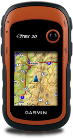
These are the ten essentials that you should have for a hiking trip as recommended by REI. Watch the video to get what these ten essentials are about. The ten essentials should give you an idea of what you should be packing for a hiking trip even for a day trip. Navigation Sun protection Insulation (extra clothing) Illumination Fire Repair kit & tools Nutrition (extra food) Hydration (extra water) Emergency shelter First aid supplies REI Video: Outdoors and Recreation Online Training Videos for Outdoor Gear and Equipment References or Credits: REI Video: Outdoors and Recreation Online Training Videos for Outdoor Gear and Equipment INDEX PAGE

How to Hoist a Loaded Backpack: Expert Advice from REI

This is how you lift your heavy backpack and put it on your shoulders easily. How to Hoist a Loaded Backpack: Expert Advice from REI References or Credits: How to Hoist a Loaded Backpack: Expert Advice from REI INDEX PAGE

Backpacks: Adjusting the Fit: Expert Advice from REI

This is a video about how to adjust your backpack straps to fit your body. A must watch for those who are new to backpacking with a huge and heavy backpack. Backpacks: Adjusting the Fit: Expert Advice from REI References or Credits: Backpacks: Adjusting the Fit: Expert Advice from REI INDEX PAGE

Garmin eTrex Tips

Image
A good collection of tips and tricks for Garmin eTrex GPS unit. This is a must read website before you start to use your etrex unit. http://www.aukadia.net/gps/

Garmin eTrex 20 manuals

Image
A list of eTrex 20 user manuals for downloads. http://support.garmin.com/support/manuals/manuals.htm?partNo=010-00970-10&language=en&country=US

How to get free topographic map into Garmin eTrex 20

Image
This post will guide you on how to download the SRTM3 data to create a topographic contour map to complement your existing Garmin street maps in your Garmin eTrex 20 GPS device. You will use it like an extra layer of map on top of your existing Garmin street map. If you have not got a street map and you are interested in getting the street map for your Garmin eTrex 20 device, please refer to  How to get free routable maps into Garmin eTrex 20 .  If you are interested to get street maps for Malaysia and Singapore, please refer to  How to install malfreemaps into Garmin eTrex 20 . Malfreemaps provides a very comprehensive map of Malaysia and Singapore, more comprehensive map than the free OpenStreetMaps. Note: The steps below only applicable for Windows OS and make sure you have Java installed into your system. Steps Download  OSM2GarminTopo . This is a zip package that i have packed with mkgmap , srtm2osm and my custom batch script to automate the creation of the topographic map layer

How to get free routable maps into Garmin eTrex 20

Image
This post will guide you how to get routable OpenStreetMap(OSM) maps into your Garmin eTrex 20 GPS unit. OSM maps are not comprehensive compare to other Garmin maps that you can purchase from Garmin but never the less they are free and you have the whole world to select for download. Note: I have tested this on my Garmin eTrex 20 and i am sure that this method also works for Garmin eTrex 30 units as well. Before you start, download mkgmap and make sure you have java installed into your system because mkgmap is a java based command program. Steps Goto  Free routable maps for Garmin GPS devices  and download the Garmin map (IMG format) of the region you need. Using mkgmap, give a description ID to your map so that you can identify the map from your Garmin eTrex 20 GPS device. You can disable it if you want to. The command is: java -Xmx512m -enableassertions -jar mkgmap.jar --draw-priority=10000 --transparent --gmapsupp --description=<your map name> <downloaded map file>.i

How to install malfreemaps into Garmin eTrex 20

Image
Malaysia and ASEAN Free Maps Project Forum (malfreemaps) provides a very comprehensive free Garmin map of Malaysia and Singapore for Garmin GPS devices. Malfreemaps works perfectly well on Garmin eTrex 20. I am sure this also applies on the Garmin eTrex 30 unit as well. Steps: Download the map package from malfreemaps forum site. Refer to their installation guide provided on the download thread on how to install and copy the IMG map file into your Garmin eTrex 20. Note: You can rename the gmapsupp.img file to your name of your choice because Garmin eTrex 20 supports multiple map files (IMG) with different filenames. References or Credits: Malaysia and ASEAN Free Maps Project Forum

How to download maps for offline usage in ViewRanger Nokia Symbian

Image
This is a brief descriptions on how to create an offline map to use in ViewRanger application for Nokia 5800 XpressMusic. I use this method to create my offline topographic map (Open Cycle Map) for ViewRanger so that i can use it without going online while tracking my hiking trails. Download MOBAC . Download ViewToolRanger . Extract both downloaded applications into their respective directories. Start MOBAC and create a new atlas in Mobile Atlas Creator using the " OSM Tracker tile storage " format.  For details on how to create the atlas, please read the MOBAC documentation. Start ViewToolRanger. Go to Mobile Atlas Creator tab and setup the conversion. For details on the setup, please read the ViewToolRanger documentation. Start the conversion. Updates: 13 August 2012 Map cache location in mobile operating system: Symbian : /ViewRanger/MapCache/_PAlbTN/[layer]/[zoom]/[x]/[y] Android : /Android/data/com.augmentra.viewranger.android/cache/[layer]/[zoom]/[x]/[y] 14 August 201

How to add OSM Cycle Map as custom map source to MOBAC

A reference of how to add Open Cycle Map (topo map) into MOBAC as a custom map source. Maps downloaded can be use as offline maps for supported applications in MOBAC. Steps: Create a XML file in "<MOBAC install>\mapsources" directory. Copy the template below and paste it into the XML file. Start your MOBAC application and select the map source " OSM Cycle Map ". XML template: <?xml version="1.0" encoding="UTF-8"?> <customMapSource> <name>OSM Cycle Map</name> <minZoom>0</minZoom> <maxZoom>15</maxZoom> <tileType>png</tileType> <tileUpdate>IfNoneMatch</tileUpdate> <url>http://tile.opencyclemap.org/cycle/{$z}/{$x}/{$y}.png</url> <backgroundColor>#000000</backgroundColor> </customMapSource> References or Credits: MOBAC.net : Custom map source Open Cycle Map developer information INDEX PAGE

What does ISO means in digital photography?

Image
Another great video from Dylan Bennett about photography. References or Credits: Dylan Bennett's Learn About Photography and Video INDEX PAGE

What is Depth of Field?

Image
Don't really understand what Depth of Field is? Watch this video. References or Credits: Dylan Bennett's Learn About Photography and Video INDEX PAGE

What is F-stop?

Image
A really good video explaining what F-stop really means in photography. References or Credits: Dylan Bennett's Learn About Photography and Video INDEX PAGE

How Linux is Built

Image
This 3 minutes video of how Linux is built shows us how Linux OS had affected our daily lives and technology around us. From a different perspective, will the next major computer virus outbreak be hitting Linux OS? References or Credits: How Linux is Built OMG Ubuntu! INDEX PAGE